Do the Waterfall Crawl
Complete the Challenge to Earn Your Badge and Make Memories
Pick your favorite trail and start there, or complete the Great 8 Waterfall Crawl Challenge by hiking all 8 trails to earn yourself a Great 8 badge! Go to the interactive trail website STLCtrails.com to find all you need to know for each waterfall and more!
Where to Find the Falls
Check Out the STLC Waterfall Guide (in print and online)
A printed Waterfalls Guide for St. Lawrence County is available, with an electronic version available here, or you can print out the information from this website. We also have an interactive trail map to help you plan your hikes. Have fun discovering and you’ll understand why we say “Naturally Fun(!) St. Lawrence County.”
A Few of Our Favorite Falls to Discover ...
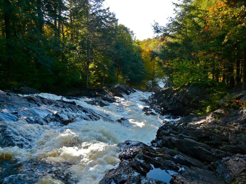
Harper Falls
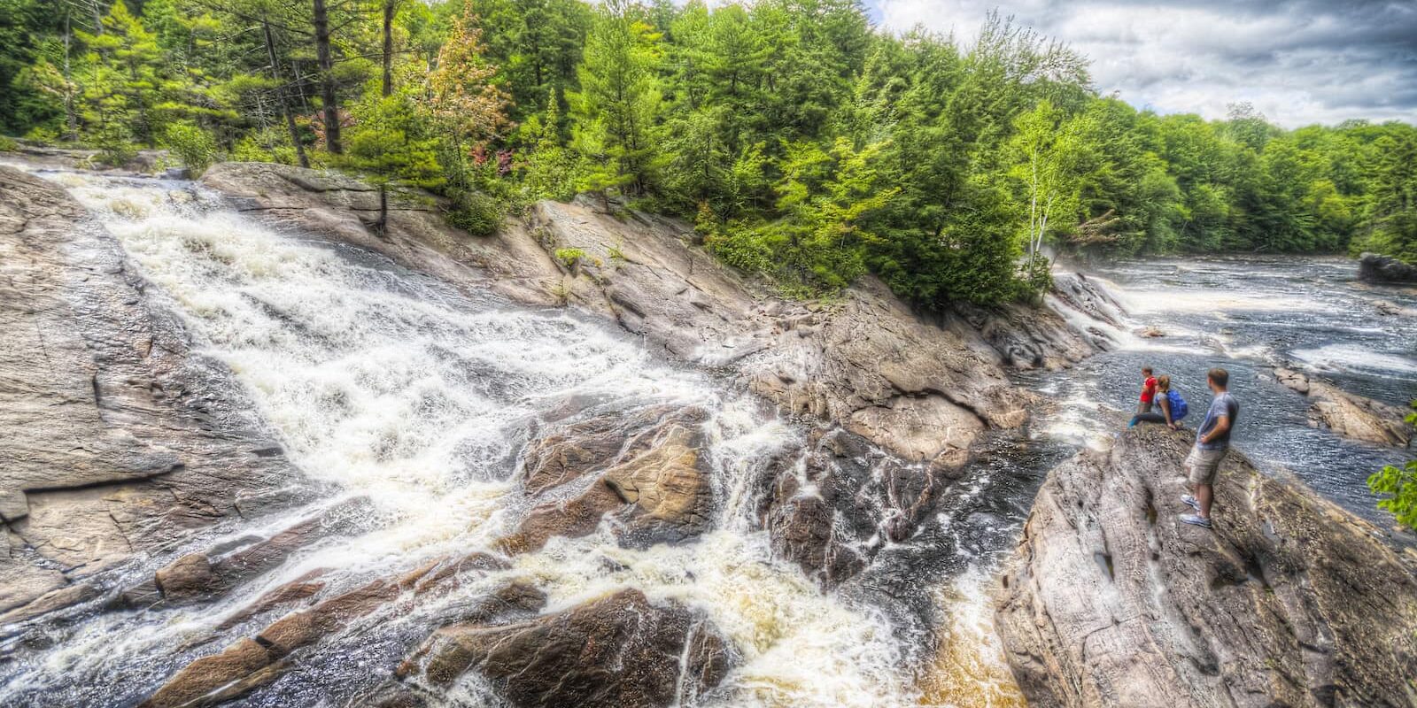
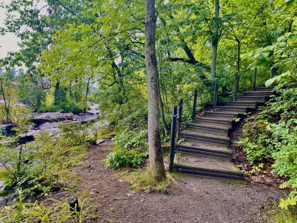
Harper Falls is on the North Branch of the Grasse River. The hike into this area is almost as beautiful as the falls itself.
View the interactive trail map for Harper's Falls Trail on STLCtrails.com/harpersfallstrail
Directions:
From the intersection to the trail parking is ½ mile on the Donnerville Road which is dirt and gravel and is shared with ATV users, so please use caution as there are several blind hills and turns. Starting from Donnerville Road and walking up the river toward Harper Falls offers a relaxing trek, with a couple of hills and small creek crossings.
Once at the falls do not only observe them from a distance, take a walk to the top for that "up close feeling". While walking up you may notice the path has stone walls along the edge. These are the remnants of an old sawmill. This mill was made during the time the town of Donnerville was active and running.
There is an alternate hike as well for Harper Falls, which is from the opposite end of Donnerville Road, which intersects with County Route 24. The drive in is about 1.75 miles. This hike is about 2 miles to the falls. There is also the remnants of an old cemetery on this end of Donnerville Road.
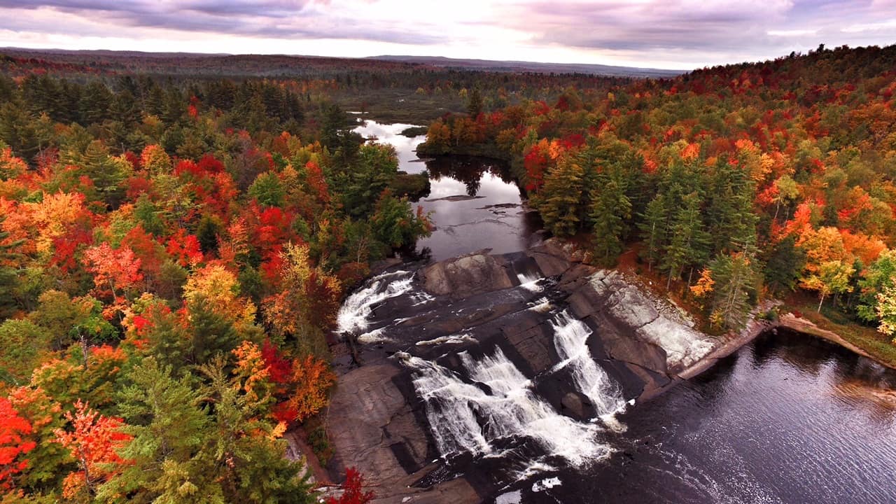
Lampson Falls
Lampson Falls, the most popular waterfall in St. Lawrence County, is easily accessed at the Degrasse State Forest on Route 38. An impressive falls at an estimated 40 feet tall and 100 feet wide. Lampson is a shallow and broad-faced falls, which can have huge amounts of water flowing over it during peak melt season in the spring. During the summer it calms and becomes a much quieter setting. At the bottom of the falls a small beach has formed allowing for swimming and picnicking. The 15 minute walk into this area is well worth it.
View the interactive trail map for Lampson Falls on STLCtrails.com/lampsonfalls
Directions:
The access for Lampson Falls is the Grasse River Recreation Area on Route 27 in Clare, just north of Degrasse. Look for the brown and yellow DEC sign at a gated road. Park on the road side and head down the dirt road.
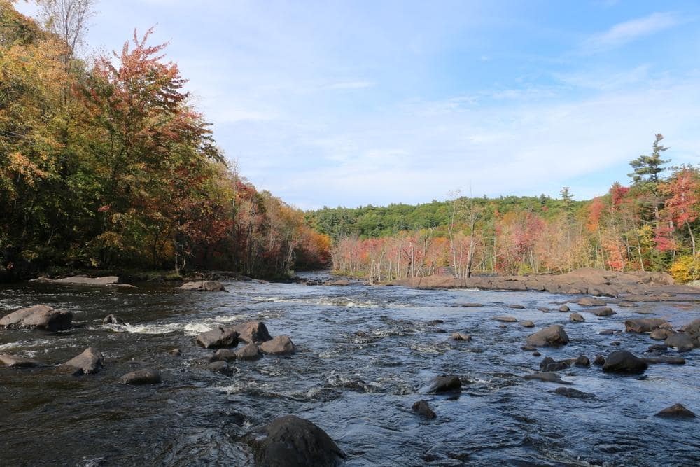
Stone Valley
The trail in Stone Valley is one of the most popular nature walks in the North Country. Following the shores of the Raquette River through Colton, the scenery is amazing. There are a series of waterfalls that continue for a mile or more along the trail, which extends for two or more miles. During the spring, the power of the highwater from the snow melt in the Adirondacks is impressive. In winter months expect the beginning of the trail to slippery and use caution when walking along the river.
The River offers experienced kayakers a challenge and canoeists should not consider padding this section of the river. There are a series of signs along the path describing some of the geological features of the area. To the geologists this is a unique area, the connection of the Adirondack Mountains and the St. Lawrence Lowlands. Watch for the signs posted on the trees to learn more.
View the interactive trail map for Stone Valley Trail on STLCtrails.com/stonevalleytrail
Directions:
From Route 68, turn left on to Route 56 in Colton. At the Hepburn Library, turn right. There ae two access points to the trails, one before the bridge near the Colton Historical Society, and one across the bridge near the Colton Fire Department.
If you are coming from Route 56 north, take a left at the Hepburn Library.
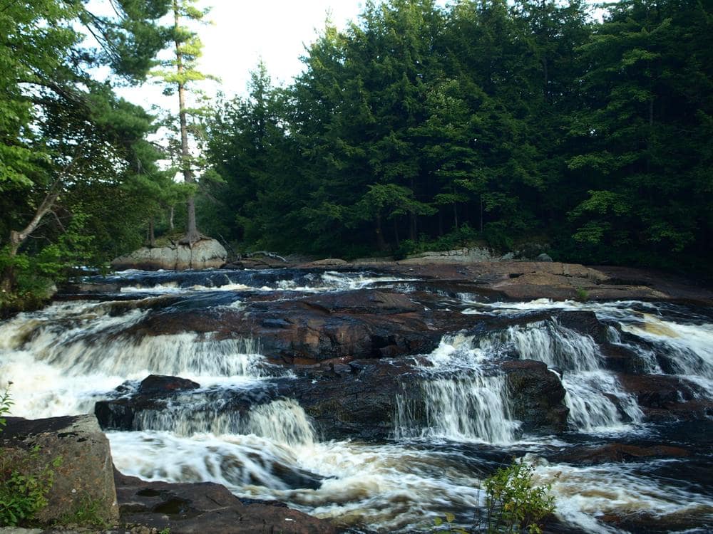
Tooley Pond
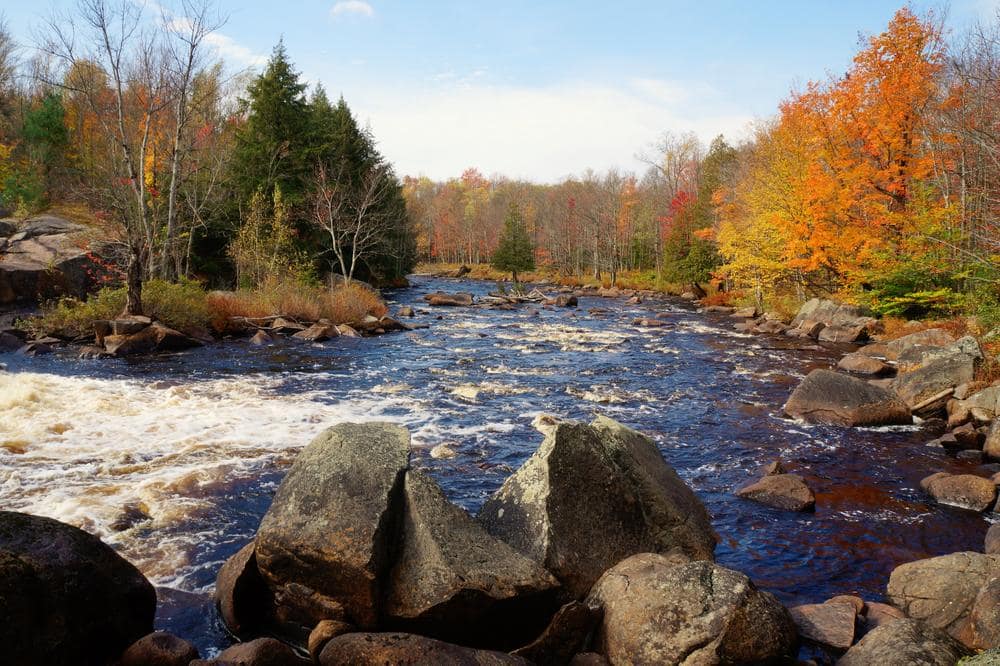
The land along Tooley Pond Road is the Northern River Flow-Tooley Pond Tract, which is a section of the New York DEC public lands, allowing access to this simply amazing place. A 16-mile section of the South Branch of the Grasse River meanders within the tract. Along this stretch, six major waterfalls exist with a variety of named rapids. The falls include: Rainbow Falls, Bulkhead Falls, Flat Rock Falls, Twin Falls, Sinclair Falls and Basford Falls. They range from the 40 foot drop of Rainbow Falls to the gentle sloped falls at Sinclair Falls, a perfect place to have lunch. The South Branch of the Grasse has excellent kayaking and canoeing with easy carries around the falls, if you do not desire to take the express route. There is good fishing in the area, but check for special regulations on the South Branch of the Grasse River. There is also an enjoyable hike up Tooley Pond Mountain at the southern end of the road.
Little exploration of the area had taken place until the 1860s when iron was discovered in the region. In 1866 the town of Clarksboro was established near Twin Falls on the shore of the Grasse River. An iron furnace and water-run sawmill were built to support the town. The foundation of the sawmill can still be seen at the top of Twin Falls. This is one of the only artifacts left of the town of Clarksboro. Iron was mined in this region until the 1950s when the mines closed because of low iron prices. Exploring this area can reveal the unique history of the County and show some of the best hidden waters.
View the interactive trail map for Tooley Pond on STLCtrails.com/tooleypond
Directions to Tooley Pond Road:
From the south or east: Turn north on Tooley Pond Road from NY Route 3, about a mile west of Cranberry Lake (right-hand turn).
From the north and west: Tooley Pond Road is located three-quarters of a mile east of Degrasse, along St. Lawrence County Route 27.
Directions to the Falls:
Some of the falls can be seen from the road, while others are a short walk along trails. The mileage below is for starting at the northern end of Tooley Pond Road in Degrasse. There are no parking areas for many of the falls, so one will have to pull to the side of the road as far as possible.
Basford Falls: 1.4 miles | Follow trail to falls. View the interactive trail map for Basford Falls on STLCtrails.com/basfordfalls
Sinclair Falls: 2 miles | Sinclair Falls is located just South of Lake Gorge Road. There is a small information stop in the parking lot. View the interactive trail map for Sinclair Falls on STLCtrails.com/sinclairfalls
Twin Falls: 3.1 miles | Before, there is a dirt road giving a good view of both falls. After is the top of the falls, where the mill was located.
Stewart Rapids: 3.3 miles | Can be seen from the road, large turn in the river.
Bulkhead Falls: 3.5 miles | Right before turn in the road, follow old road marked no vehicles to the falls.
Rainbow Falls: 6.1 miles | Look for a clearing marked off with boulders. Follow old road to the river, cross foot bridge to island and continue walking on path until you see the falls. View the interactive trail map for Rainbow Falls on STLCtrails.com/rainbowfalls
Copper Rock Falls: 8.6 miles | Look for red blaze on tree along with sign including fishing regulations. This is the beginning of the trail, follow white marked path to water and falls. View the interactive trail map for Copper Rock Falls on STLCtrails.com/copperrockfalls
Updates & Highlights
(see more from the STLC Blog) Fireworks, Parades & More Fun Things to Do for July 4th! Is your favorite event missing?…
Read More(see more from the STLC Blog) Top 6 Trails in Canton, New York St. Lawrence County is home to countless miles of…
Read More(see more from the STLC Blog) * Updated for the 2024 Season * Find fresh produce & local delights this Spring/Summer/Fall! Is…
Read More(see more from the STLC Blog) Total Solar Eclipse Activities & Viewing Events To see ALL of the TOTALLY awesome TOTALITY events…
Read More

